A hurricane hunter aircraft was inside Erin when it reached category 5 this Saturday in Caribbean waters, with maximum sustained winds of 255 km/h, making it the most powerful cyclone of the season.
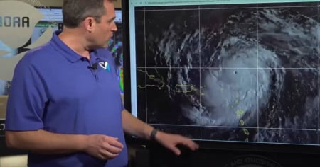
On a reconnaissance mission, the WP-3D Orion aircraft, known as a hurricane hunter, entered the center of the system and recorded the extreme conditions of its intensification at the moment it reached the highest category on the Saffir-Simpson scale.
The Cuban meteorologist Henry Delgado, a member of the Cárdenas Photography Club and a specialist at the Varadero International Airport, shared the crew's experience on Facebook: “Incredible and impressive! It was a historic moment to detect Erin's leap to Category 5 within the very eye of the hurricane.”
According to the National Hurricane Center (NHC) in Miami, Erin was located this Saturday about 105 miles north of Anguilla, moving west at 27 km/h.
Although it is not expected to make landfall in the Caribbean, the Leeward Islands, Puerto Rico, and the Virgin Islands are already experiencing its effects, with heavy rains, high waves, and a risk of landslides.
Meteorologists predict that in the coming days, the cyclone will make a turn toward the northeast, moving away from the Caribbean and positioning itself between the east coast of the United States and Bermuda, with the latter having a higher possibility of close impact.
For now, Cuba is not in direct danger, as the hurricane remains north of the eastern Caribbean. However, experts warn that a system of such magnitude always poses a potential risk due to possible sudden changes in its trajectory.
The NHC warned that Erin, currently compact, will increase in size over the coming days, leading to very dangerous maritime conditions in the western Atlantic.
Erin is the fifth named storm of the 2025 season and the first to reach hurricane strength, directly attaining the highest category on the Saffir-Simpson scale, a fact that highlights the intensity with which this hurricane season is unfolding.
Frequently asked questions about Hurricane Erin
What category has Hurricane Erin reached?
The hurricane Erin has reached Category 5, becoming the most powerful cyclone of the 2025 season, with maximum sustained winds of 255 km/h.
What areas have been affected by Hurricane Erin?
The hurricane Erin is impacting the islands of the Lesser Antilles, Puerto Rico, and the Virgin Islands with torrential rains, high waves, and risk of landslides. Although it is not expected to make landfall in the Caribbean, its effects are already being felt in these areas.
Is Cuba in danger from Hurricane Erin?
Currently, Cuba is not in direct danger from Hurricane Erin, as it is located north of the eastern Caribbean. However, there is always a potential risk due to possible sudden changes in its trajectory.
What is the anticipated path for Hurricane Erin?
It is expected that Hurricane Erin will make a turn towards the northeast in the coming days, positioning itself between the east coast of the United States and Bermuda. Bermuda has a higher likelihood of experiencing a close impact.
Filed under: