
Related videos:
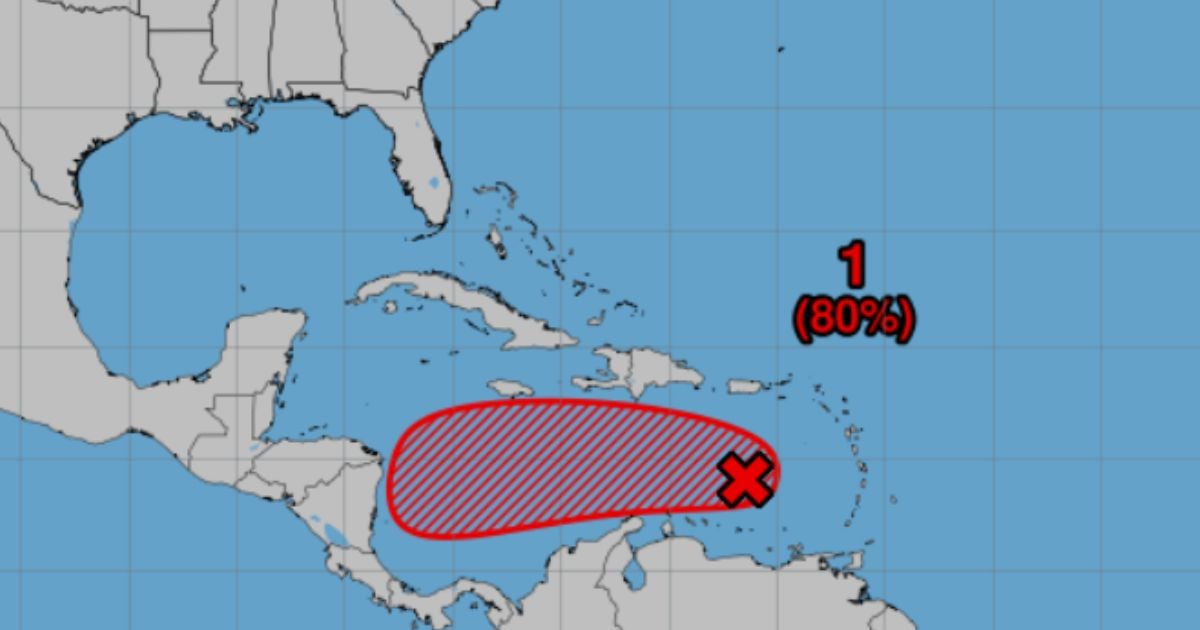
The National Hurricane Center (NHC) is monitoring an active tropical wave in the eastern Caribbean Sea, which could develop into a cyclonic system in the coming days, although there is uncertainty regarding its future path.
According to the advisory issued at 8:00 a.m. (Eastern Time) on Monday, October 20, the phenomenon—identified as AL98—has an 80% chance of cyclonic development in the next seven days and a 50% chance in the next 48 hours.
The wave is moving west at a speed of between 24 and 32 kilometers per hour, and it is expected to reduce its movement as it approaches the central Caribbean.
The NHC specified that the wave is generating a wide area of rain and thunderstorms to the east of its main axis, and that atmospheric conditions will become more favorable for its development in the coming days.
If it intensifies, it could become, before the weekend, the next tropical depression or storm of the current hurricane season.
“ We continue to monitor the tropical wave AL98 in the eastern Caribbean, which has a high probability (80%) of cyclonic development in the coming days as it slowly moves toward the central Caribbean,” published the NHC on its official account on X.
Although heavy rains and strong winds are beginning to diminish over the Windward and Leeward Islands, the agency warned that they could extend to the ABC Islands (Aruba, Bonaire, and Curacao) in the coming days.
In the Facebook group "Meteorología_Cuba", the specialist MSc. Álvaro Pérez Senra explained that the models show uncertainty regarding the system's trajectory.
"It is evident that the FNV3 model sees two possible scenarios: an initial recurvature that can have two solutions: the system is captured by the trough and moves northeast, or it is captured without managing to drag it, ends up without steering currents, moves again to the west or northwest, and then makes another recurvature in the western Caribbean," he noted.
Pérez warned that this system "is going to give us a lot of headaches," highlighting the difficulty in determining its final course due to the expected atmospheric changes throughout the week.
In essence, experts agree that there is still no defined path, and its evolution will depend on the upper-level currents and the interaction with a trough north of the Caribbean.
So far, the system does not pose a direct threat to Cuba, but meteorologists recommend staying alert to its development.
October is typically an active month in the Atlantic hurricane season, and the forecasts from the NHC suggest that conditions will remain favorable for the development of storms in the region.
Filed under: