
Related videos:
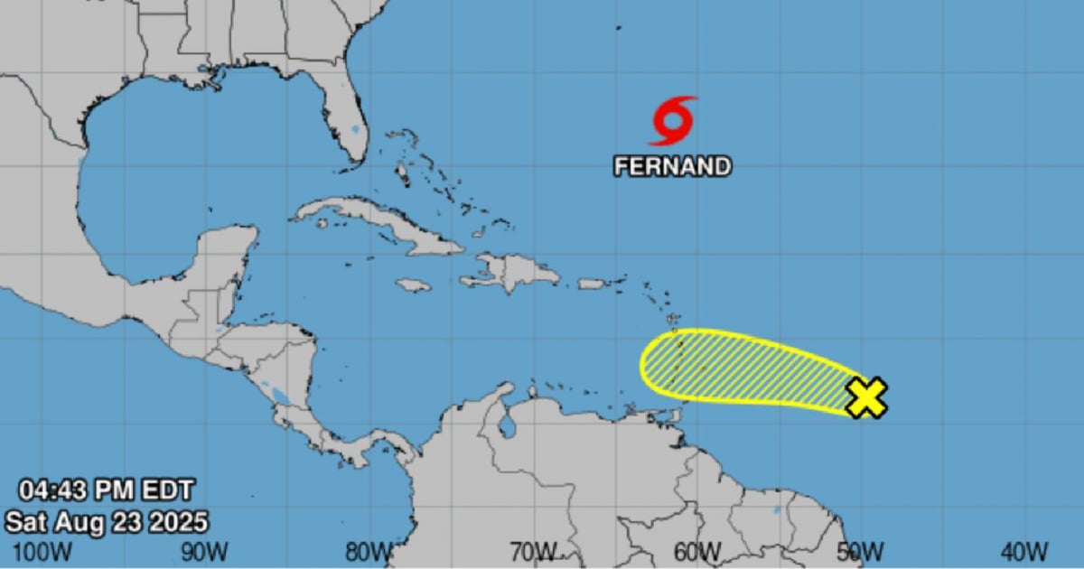
A tropical wave located about 1,045 km east of the Windward Islands continues to generate rain and thunderstorms in the region.
According to weather reports, the system is moving rapidly westward at 32-40 km/h, and it is expected to cause heavy local rains and gusty winds in some islands during Sunday and Monday.
The National Hurricane Center (NHC) indicates that the probability of tropical cyclone development for this wave is low, at 20% both in the next 48 hours and over the next seven days.
However, environmental conditions could become more favorable by the end of the week, potentially allowing for its development into a tropical depression.
Currently, the tropical storm “Fernand” is also circulating in the Atlantic, with winds of up to 40 miles per hour.
Meteorologists advise communities in the Eastern Caribbean and the Lesser Antilles to stay alert for official reports.
The Atlantic hurricane season, active from June 1 to November 30, reaches its climatic peak in September, and experts remind us that current conditions—warm waters, low wind shear, and high humidity—favor the formation of cyclones.
The population is advised to constantly monitor official bulletins and follow the instructions of local authorities in case of any eventuality.
Frequently Asked Questions about the Tropical Wave in the Atlantic and the 2025 Hurricane Season
What is the likelihood of the tropical wave developing into a cyclone?
The probability of cyclonic development of the tropical wave is low, at 20% both in the next 48 hours and over the next seven days. However, conditions could become more favorable by the end of the week, allowing for its evolution into a tropical depression.
What precautionary measures should Caribbean communities take?
The communities of the Eastern Caribbean and the Lesser Antilles must remain vigilant to official reports and follow the instructions of local authorities. The hurricane season is at its peak, and current conditions are conducive to the formation of cyclones.
How is the hurricane season in 2025 shaping up in the Atlantic?
The 2025 Atlantic hurricane season is expected to be more active than usual, with a forecast of up to 19 named storms and 10 hurricanes. This increase in activity is primarily due to high ocean temperatures and the likely absence of the El Niño phenomenon.
What is the impact of Saharan dust on cyclone formation?
The dust from the Sahara can inhibit the development of tropical cyclones by creating a dry environment that limits the moisture necessary for their formation. This has been a factor in the low probability of development of some tropical waves in the Atlantic.
Filed under: