
Related videos:
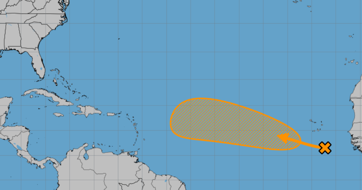
The National Hurricane Center (NHC) issued a watch report on Monday regarding a tropical wave located in the eastern Atlantic, to the south-southeast of the Cape Verde Islands.
According to the report from the institution, the system is generating disorganized areas of rain and thunderstorms, but the environmental conditions in the region could favor gradual development in the coming days.
The NHC estimated a 10% chance of cyclonic formation in the next 48 hours, although the figure increases to 50% over a seven-day period.
If it becomes more organized, the tropical wave could turn into a tropical depression by the middle or end of the week.
The phenomenon is moving west to west-northwest at a speed of about 24 km/h (15 mph), traveling over the waters of the central and eastern tropical Atlantic.
However, due to the potential trajectory, this atmospheric disturbance must be closely monitored by meteorologists, and the Cuban population, along with those in other Caribbean nations, should remain vigilant.
Also this Monday, a Cuban meteorologist reminded that September marks the most active period of the hurricane season, so it is advised to take extra precautions.
Christian Jesús Muñiz Carrillo explained in a post on Facebook that between 1950 and 2023, nine hurricanes made landfall in Cuba during the month of September.
These were: Easy (1950), Hilda (1955), Ella (1958), Inez (1966), Georges (1998), Isidore (2002), Ike (2008), Irma (2017), and Ian (2022). Irma holds the record for being the only Category 5 hurricane to hit the island with such intensity.
Hurricane Ella has been the earliest, arriving on September 1, while the latest was Inez, on the 30th of the same month.
Ike and Irma made landfall on September 7 at almost identical times, around 9:00 and 10:00 p.m., respectively, the specialist recalled.
Frequently asked questions about the tropical wave in the Atlantic and the hurricane season
What is the probability that the tropical wave in the Atlantic will develop into a cyclone?
The likelihood of the tropical wave developing into a tropical cyclone is 10% in the next 48 hours and increases to 50% in seven days. This information was provided by the National Hurricane Center (NHC), which is monitoring the system as it moves west-northwest across the tropical Atlantic.
What conditions favor the development of cyclones in the Atlantic?
The conditions that promote the development of cyclones include warm ocean waters, low wind shear, and a moist atmosphere. During the hurricane season, which peaks in September, these factors come together, increasing the likelihood of the formation of named storms and intense hurricanes.
Why is it important to monitor tropical waves in the Atlantic?
Monitoring tropical waves is crucial because they can rapidly intensify and become tropical cyclones. These systems can bring heavy rainfall, strong winds, and storm surges, affecting communities in the Caribbean and other coastal areas. Vigilance and preparedness are essential to minimize damage and protect vulnerable populations.
How many storms are expected during the 2025 hurricane season?
Between 13 and 18 named storms are expected, of which between 5 and 9 could become hurricanes. This forecast was made by the National Hurricane Center and reflects above-average cyclonic activity due to factors such as the warming of the Atlantic Ocean.
Filed under: