
Related videos:
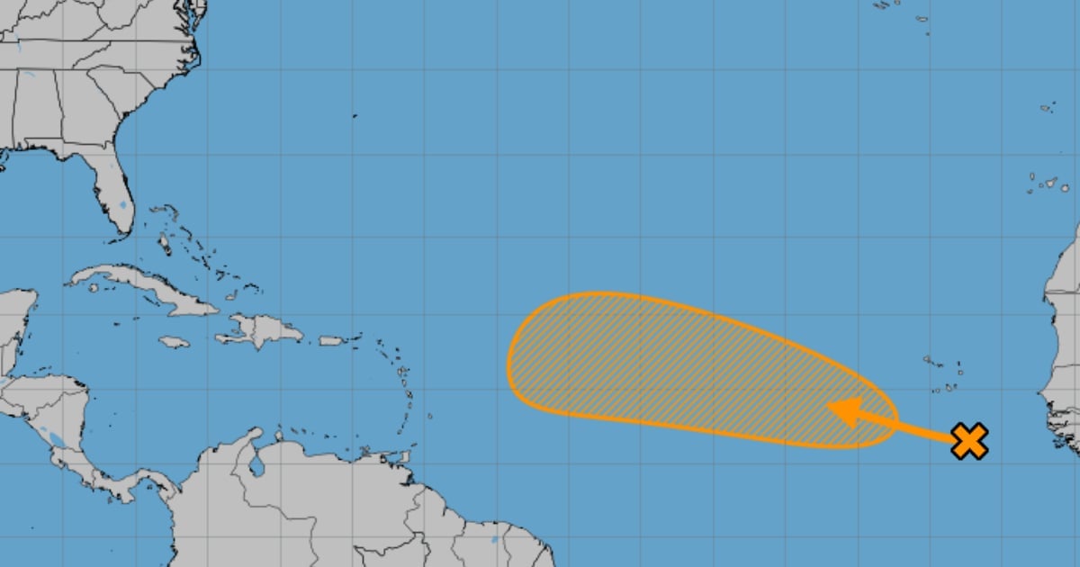
The tropical wave that left Africa this past Sunday—a system under observation since the previous week—continues to move across the central Atlantic without showing a clear organization for now.
According to the site Local 10 News, it currently only produces scattered areas of rain and isolated storms.
Inconsistent models
The main forecasting models suggest a gradual development towards the end of this week and through the weekend. However, the projections have shown significant variability, reflecting a high level of uncertainty regarding their evolution and trajectory.
Experts advise residents of the Eastern Caribbean and the Lesser Antilles to stay alert for upcoming reports, particularly as the weekend approaches. If there is any risk to the islands, it would likely occur in the middle or towards the end of next week.
Factors that limit its development
In the short term, the system faces unfavorable conditions due to strong winds at high levels and the presence of dry air, which would limit its organization.
By next week, the environment could become somewhat more favorable as the Atlantic enters a more favorable phase of the Madden-Julian Oscillation (MJO), although obstacles for significant strengthening would still persist.
Differences between models
The American GFS model maintains a projection of a rapid turn to the north, although it is less aggressive than earlier in the week. Meanwhile, the European model has shown a similar trend, placing possible scenarios further north and east of the Antilles.
In conclusion, the system remains under observation, but it is still early to discuss direct impacts. The main recommendation is patience and constant monitoring of official reports as the tropical wave better defines its path and development potential.
Frequently Asked Questions about the Tropical Wave in the Atlantic
What is the current status of the tropical wave in the Atlantic?
The tropical wave is located in the central Atlantic without a clear organization. Although it is generating scattered areas of rain and isolated storms, current conditions, such as strong winds at high levels and dry air, are limiting its development. However, there is a possibility of gradual development toward the weekend.
What do the forecast models say about the evolution of this storm?
The main forecasting models, such as the GFS and the European model, show great variability in their projections, reflecting a high level of uncertainty regarding their evolution and trajectory. While the GFS suggests a rapid turn to the north, the European model also positions the possible scenarios further north and east of the Antilles.
What are the recommendations for residents of the Eastern Caribbean and the Lesser Antilles?
Residents are advised to stay alert for official reports, especially towards the end of the week, as any potential risk to the islands is expected to arise in the middle or towards the end of next week. Experts suggest patience and constant monitoring of the reports.
What factors could influence the development of the tropical wave?
Conditions such as strong winds at high altitudes and the presence of dry air are currently limiting the development of the tropical wave. However, by next week, the environment could become more favorable due to the conducive phase of the Madden-Julian Oscillation (MJO), although obstacles for significant strengthening would persist.
Filed under: