
Related videos:
The municipality of Guamá began to experience this Monday the
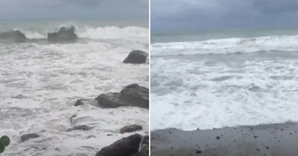
Videos shared by the internet user Walter Léon reveal a turbulent and dangerous tide, while provincial authorities are touring vulnerable areas to verify preparations and expedite safety measures in response to the approaching phenomenon.
The president of the Provincial Defense Council, Beatriz Johnson Urrutia, and the vice president Manuel Falcón Hernández visited Guamá this Sunday, where the safety of the population, accessibility, and communication become particularly challenging during weather events.
The authorities insisted on the channeling of rivers and critical points: Guamá has 32 rivers, including Boca de Dos Ríos, Cojima, Macío, and Sevilla—the latter being deemed the most dangerous due to its history of cutting off the area—therefore, channels and drainage systems are being reviewed to mitigate floods and secure strategic routes.
At the same time, the protection of homes and economic resources is being monitored, and the productive centers of the municipality were checked to ensure that material means and resources are available to address the impacts of Melissa.
The agenda included monitoring the coffee harvest in the mountains —which, according to the official report, “has been recovering”— and inspecting prioritized energy facilities.
The local report concludes that, in the current context, "decisive" are the advanced actions to mitigate damage: from controlling rivers and roadways to securing solar parks and protecting coastal and mountain communities.
With the increasing swell and choppy tides, the call is to exercise utmost caution, adhere to guidelines, and follow official channels as Melissa progresses over the western Caribbean.
From Santiago de Cuba, the authorities assured that there has been an emphasis on the municipality of Guamá, which was recently affected by the storm Imelda; while the Protesta de Baraguá and Carlos Manuel de Céspedes reservoirs are being monitored.
In Granma, the situation is complex with swollen rivers, reservoir overflow, and coastal flooding due to the nighttime high tide in the Gulf of Guacanayabo, which hinders the natural drainage of water. As a result, 15% of the population will be evacuated, totaling 66,000 to evacuation centers.
The dangerous hurricane Melissa
The National Hurricane Center (NHC) reported on Monday afternoon that Melissa maintains maximum sustained winds of 175 mph (280 km/h), a central pressure of 906 mb, and continues as a category 5 hurricane, moving very slowly to the northwest.
In its latest report, the NHC states that the eye was located at 16.7°N, 78.4°W, approximately 140 miles (225 km) southwest of Kingston, Jamaica, and 320 miles (515 km) southwest of Guantánamo, Cuba.
The NHC warns that catastrophic winds threatening life, flooding, and storm surge are imminent in Jamaica between tonight and Tuesday.
The core of the system will move near or over Jamaica during that time, traverse the southeast of Cuba on Tuesday night, and continue over the southeast or central Bahamas on Wednesday, while gradually turning north and then northeast, accelerating between Tuesday and Thursday.
Despite potential fluctuations in intensity before making landfall in Jamaica, the official forecast maintains Melissa as an extremely powerful major hurricane as it approaches Jamaica and southeastern Cuba, and it will still be a hurricane as it travels through the Bahamas.
Filed under: