
Related videos:
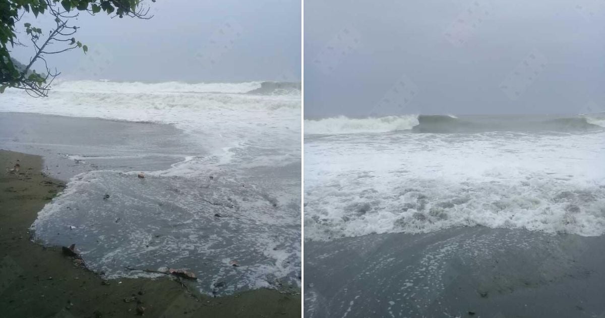
Hurricane Melissa continues its advance through the Caribbean and has begun to slowly move northwest, generating strong swells with waves between 2.5 and 4 meters off the southern coast of Cuba, particularly against the shores of Granma, Santiago de Cuba, and Guantánamo.
According to the Tropical Cyclone Warning No. 16 issued this Monday by the Instituto de Meteorología de Cuba (INSMET), Melissa remains a Category Five hurricane on the Saffir-Simpson scale, with maximum sustained winds of 280 kilometers per hour, higher gusts, and a central pressure that has dropped to 906 hPa, making it an extremely dangerous hurricane.
The report specifies that the strong swells are already affecting the southeastern coast, where waves can reach heights of between 2.5 and 4 meters, causing minor to moderate flooding in low-lying coastal areas.
Experts warned that maritime conditions will continue to deteriorate as the hurricane approaches.
At six in the evening, the eye of the hurricane was estimated to be at 16.7 degrees north latitude and 78.4 degrees west longitude, about 215 kilometers southwest of Kingston, Jamaica, 350 kilometers south-southwest of Cabo Cruz, Granma, and 460 kilometers southwest of Santiago de Cuba.
The system is slowly moving northwest at a translational speed of six kilometers per hour.
Specialists warned that over the next 24 hours, the hurricane will shift its trajectory toward the north and then to the northeast, moving faster and approaching the southern coast of the eastern region of Cuba between Tuesday afternoon and evening.
In addition, the outer bands of the cyclone are increasing cloudiness and rainfall in the eastern part of the country, with heavy and intense precipitation in some mountainous areas.
The wind, blowing from the northeast to the east, is sustained at speeds between 35 and 50 kilometers per hour, with gusts that could exceed tropical storm force during the night.
The INSMET Forecast Center reiterated that Melissa will remain a major hurricane as it passes through Jamaica and approaches Cuba, and confirmed that close monitoring of its development and future path is ongoing.
The next tropical cyclone advisory will be issued at midnight this Monday.
The meteorologist José Rubiera warned this Monday that Melissa is now a "gigantic, monstrous Category 5 hurricane" approaching Jamaica.
In the latest update on his YouTube channel, the expert warned that, after crossing the island between night and dawn, Melissa could be captured by a trough and accelerate towards eastern Cuba as a highly intense cyclone—possibly Category 4 or 3—between Tuesday night and Wednesday morning.
“It is extremely dangerous,” he emphasized, after specifying that the system has a small eye, maximum sustained winds of 270 km/h, and gusts exceeding 300 km/h, with the center located about 200 kilometers southwest of Kingston.
Filed under: