
Related videos:
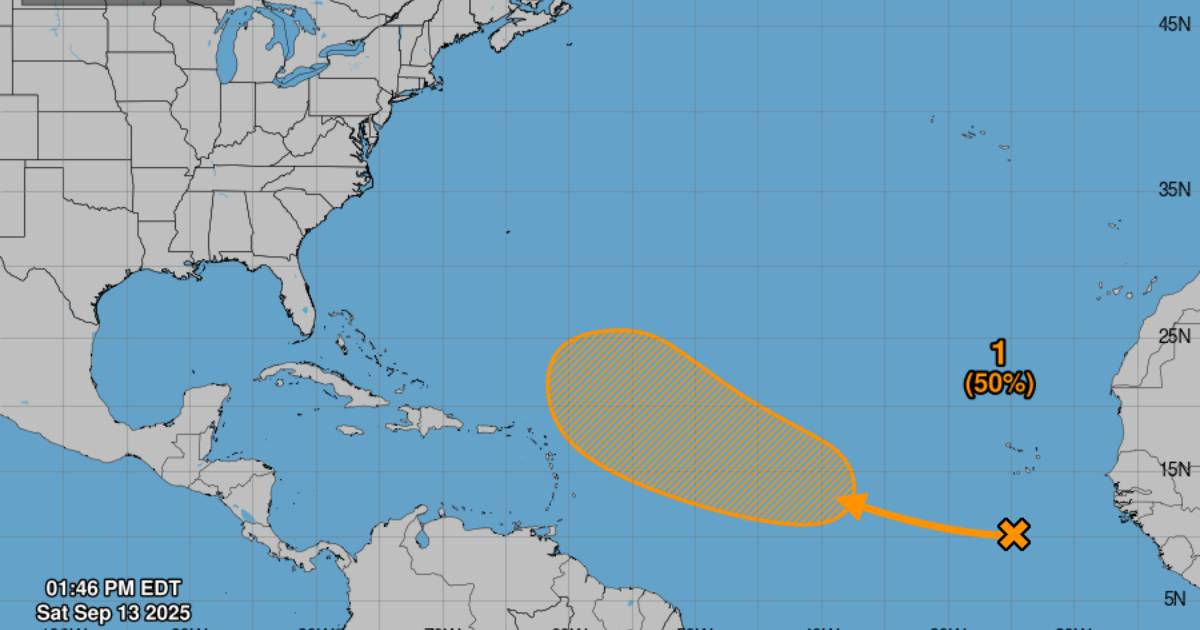
The National Hurricane Center (NHC) of the United States issued an early advisory this Saturday regarding a tropical wave moving from the vicinity of the Cape Verde Islands in the eastern Atlantic, which could develop into a tropical depression in the coming days.
The agency explained that, although the dry and stable air currently limits the development of this system, the conditions could become more favorable by the middle or end of next week, as it moves northwestward at a speed of 10 to 15 miles per hour over the central Atlantic.
At 2:00 p.m. (Eastern Time), the NHC estimated a zero percent chance of cyclonic formation in the next 48 hours, but raised it to a 50 percent chance in the next seven days, placing the phenomenon in a watch scenario.
For Cubans, who still remember the impact of recent hurricanes and remain vigilant during the cyclone season, any warning of this kind raises concern. Although the system is still far from the Caribbean, experience has shown that trajectories can change, and early preparedness is key.
Meteorologists recommend closely following official updates from the NHC and the Cuban Institute of Meteorology (INSMET), without getting swayed by rumors or speculation on social media.
The Atlantic hurricane season began on June 1 and will last until November 30, a period during which the region typically faces the highest risks of storms and hurricanes.
Frequently Asked Questions about the Possible Formation of a Tropical Depression in the Atlantic
What is the probability that the tropical wave will develop into a tropical depression?
The likelihood of cyclonic formation from the tropical wave is 50% in the next seven days. According to the National Hurricane Center (NHC), conditions could become more favorable by the middle or end of next week, increasing the chances that the system will strengthen and turn into a tropical depression.
What is the expected path of the tropical wave?
The tropical wave is expected to move west-northwest over the central Atlantic at a speed of between 10 and 15 miles per hour. Although it is currently far from the Caribbean, the paths of these phenomena can change, so it is crucial to follow official updates from the NHC.
How does this situation affect Cuba and the Caribbean?
Although the system is still far from the Caribbean, experience has shown that the paths of these phenomena can change. Therefore, it is important for residents in Cuba and other islands in the Caribbean to stay informed through official channels and to follow updates from the NHC and the Cuban Institute of Meteorology (INSMET).
Why is it important to be prepared during hurricane season?
The hurricane season in the Atlantic is at its most active stage, which runs from June 1 to November 30. Historically, September has been a critical month for the impact of hurricanes in Cuba, with several significant events. Early preparation and constant vigilance are key to mitigating the risks associated with these weather phenomena.
Filed under: