
Related videos:
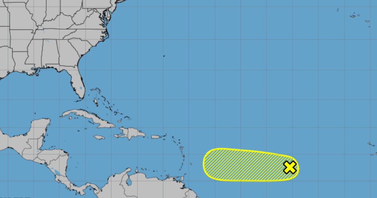
A tropical wave located in the central Atlantic is moving westward, heading towards the Caribbean Sea, as reported by the National Hurricane Center (NHC).
According to the weather reports, the wave is producing a small area of rainfall. The environmental conditions only slightly favor development, and the chances of this system becoming a tropical depression continue to decrease.
It is expected that the wave will generally move westward at a speed of between 10 and 15 miles per hour, and it is likely that it will be near the Lesser Antilles by the middle of next week.
The wave is moving generally westward, and it is expected to accelerate its speed to 10-15 knots in the coming days.
The forecasts indicate that it could approach the Lesser Antilles in the middle of next week, so it is advised for the populations of that region to stay alert to its development.
In addition to this phenomenon, another tropical wave is located in the center of the Caribbean, along 71 degrees west longitude, between Hispaniola and the northwest of Venezuela, moving westward with scattered convection.
In the Gulf of Mexico, a low pressure system and several surface troughs are causing isolated rain and thunderstorms, while the arrival of a cold front to the north of the Gulf is expected at the beginning of next week.
The Cuban meteorologist Christian Jesús Muñiz Carrillo warned that the hurricane season is entering its most active phase, as September is historically the month when the peak of hurricane formation occurs in the Atlantic.
According to the explanation, between 1950 and 2023, nine hurricanes have made landfall in Cuba during the month of September.
Based on records from 1851 to 2024, it is noteworthy that in the first 10 days of September, 264 tropical cyclones have formed in the North Atlantic basin.
Fernández also noted that the formation of cyclones in this month tends to concentrate in the western tropical Atlantic, the Caribbean Sea, the Gulf of Mexico, and the central and western Atlantic.
Frequently Asked Questions about the Progress of Tropical Waves towards the Caribbean
What is the current situation of the tropical wave in the central Atlantic?
The tropical wave in the central Atlantic is moving westward towards the Caribbean Sea, but the environmental conditions only slightly favor its development. The chances of it becoming a tropical depression are decreasing, although residents of the Lesser Antilles are advised to stay alert to its evolution.
Why is September a critical month for hurricanes in the Atlantic?
September is historically the most active month for hurricane formation in the Atlantic due to favorable climatic conditions, such as warm ocean temperatures and low wind shear. Between 1950 and 2023, nine hurricanes have impacted Cuba during this month, including the intense Ike, Irma, and Ian.
What measures should Caribbean populations take in the face of possible cyclones?
The populations of the Caribbean must stay informed through official channels and follow updates from the National Hurricane Center (NHC) during hurricane season. It is crucial to have an emergency plan in place and to remain vigilant regarding the development of potentially dangerous systems.
What is the probability that the tropical wave south of the Cape Verde Islands will develop into a cyclone?
The National Hurricane Center has raised the likelihood of tropical cyclone development to 70% for a tropical wave located south of the Cape Verde Islands over the next seven days, as it moves west-northwest toward the Caribbean.
Filed under: